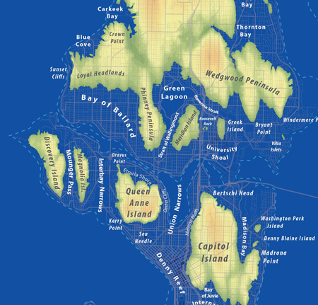
What would happen if all the world’s ice sheets melted, raising the ocean by 240 feet? UW planner Jeff Linn created a Seattle map that illustrates the new geography, playfully renaming different parts of the city. Here’s a look at the northern neighborhoods:

Of course, it’s an extremely unlikely scenario, at least anytime soon — Linn says one estimate is 5,000 years — and he admits he created the map “as a playful piece.” But he told the Seattle Times, “I think there’s definitely a warning here for people as to what could actually happen to the city.”
Regardless of your beliefs on climate change, the map is an entertaining way to view the topography of Seattle. Our house, by the way, would be floating in the Bay of Ballard, and we can only imagine the soaring property values on the Loyal Headlands and Phinney Peninsula.
(Thanks to Jonathan for posting it in the new forum!)

